January 27, 2020
Running around Aruba; an approximate 37-mile / 60 km run covering the entire island. I've made a map to calculate the distance and to see where I need water and where I can get water. The entire Northeast side is inhabited; there are no gas stations or shops to get water. Two places where I can get water and those better be open for business otherwise I have a problem
Since I can't get supplies en-route, I have a full backpack with supplies: electrolytes, water, dates, raisins, bananas, energy gels, extra shirts, socks and a phone....
Here is the route and the elevation profile for the run
Update:
What a day in Aruba. It started of pretty OK, temperature wise but as soon as I hit 20 miles (32 KM), temp went up to a grueling 38C or 100F. Almost undoable; This part is protected from the wind (as soon as you enter Arikok National Park from the South side) and in combination with a long climb to the visitor center, this part is the hardest part of the course.
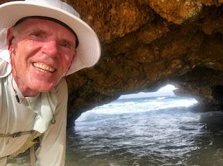
Once you are at the Natural Bridge (or the remains there of) you run for 15 miles on very rugged terrain with rocks and lots of sand. Of course I couldn't resist to kiss the ground - man I fell - bunch of scratches but it was worth it


No comments:
Post a Comment